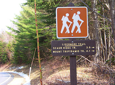
Livermore Trail heads South through Livermore Pass, 3.9 miles to Scaur Ridge Trail and 4.1 miles to Mt. Tripyramid Trail.
Livermore trail entrance on the Kancamagus Highway is across from Lily Pond. GPS coordinates are: N44° 01.059 | W071° 27.081 (elevation – 2,070′) – Keep in mind the actual trailhead is on Livermore Road at the south side of Tripoli Rd in Waterville Valley but you will find yourself hiking a 5 mile long gravel road when leaving from the actual trailhead.
Have you hiked this trail? Post information and photos of your hike below!
Subscribe
Login
0 Comments
Oldest